
Canadian Maps
139 Maps
| Maps Home >> Canada Maps >> Canada 1999 |
Image has been Resized!
 View Full Image
View Full Image
|
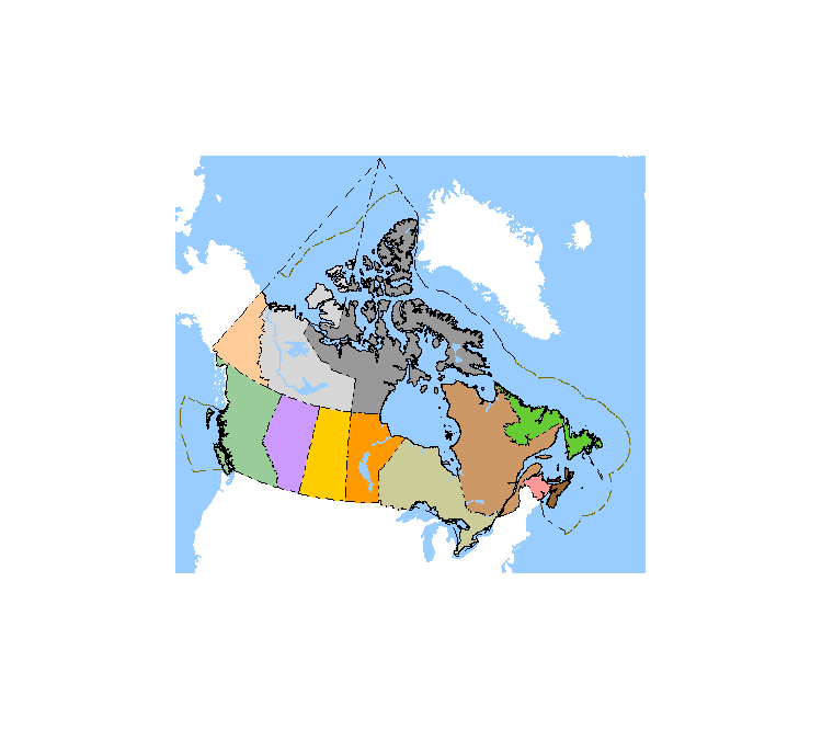
Description Canada as it exists today. Nunavut was separated from the North West Territories in 1999. The brown line indicates the 200 mile limit around Canada's coast, our national boundary for resources. International shipping is permitted closer to land. The black dashed line in the arctic indicates our national boundary, soverign territory in every way. |
Posted Comments
No comments. Why don't you go ahead and post one!?
You want to post comments ? First you must Register!
Canada Kicks Ass!
Commented Pics
 Sex Flow Chart in Gender Humour
November 15th, 2020 by cobrass Divine Light in Gender Humour
November 15th, 2020 by cobrass Ash in Babe Wallpapers
August 15th, 2020 by Vanucx Maple Leaf Collage in Maple Leaf
October 12th, 2018 by homebound Another Chinese Toy Recall in Illusions
November 6th, 2016 by Hyack
Canadian Content
Latest Topics in Canadian Forums
- Trudeau says Sask. premier is fighting CRA on carbon tax, wi
[Current Events] Last post by DrCaleb - US DEA will reclassify marijuana, ease restrictions, AP sour
[Current Events] Last post by DrCaleb
