
Canadian Maps
139 Maps
| Maps Home >> Historical Maps >> 1700's >> The St. Lawrence by Jefferys, 1776 |
Image has been Resized!
 View Full Image
View Full Image
|
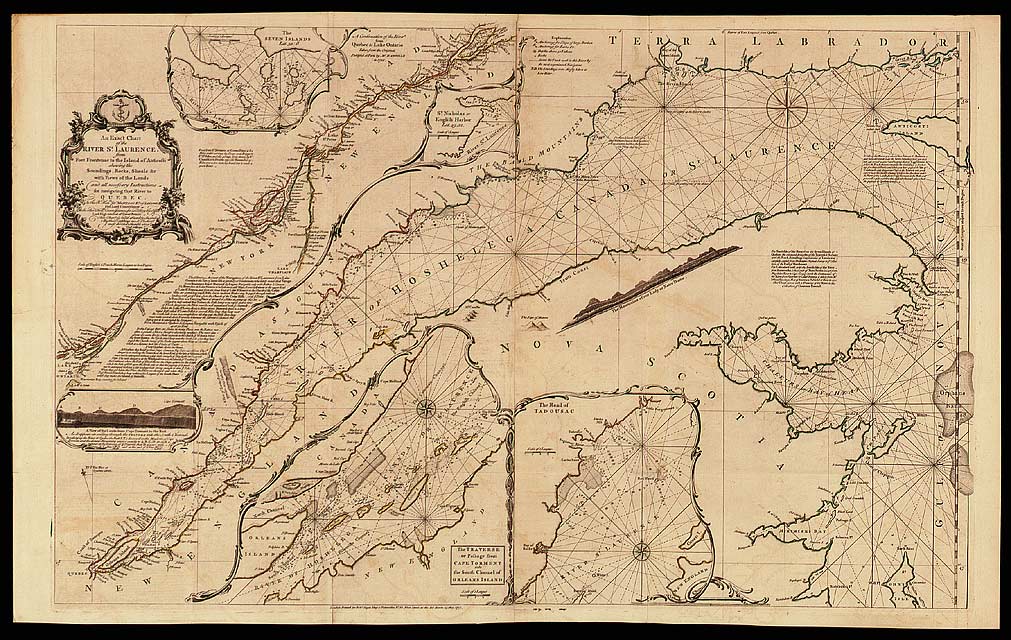
Description The St. Lawrence River was a vital artery for the colonial powers, and for this reason, Bellin, dAnville, Cook and others published attractive charts of it. This particular chart was first published in 1757. In addition to the main chart, there are insets (small charts) of good ports and basins along the river.
|
Posted Comments
No comments. Why don't you go ahead and post one!?
You want to post comments ? First you must Register!
Canada Kicks Ass!
Commented Pics
 Sex Flow Chart in Gender Humour
November 15th, 2020 by cobrass Divine Light in Gender Humour
November 15th, 2020 by cobrass Ash in Babe Wallpapers
August 15th, 2020 by Vanucx Maple Leaf Collage in Maple Leaf
October 12th, 2018 by homebound Another Chinese Toy Recall in Illusions
November 6th, 2016 by Hyack
