
Canadian Maps
139 Maps
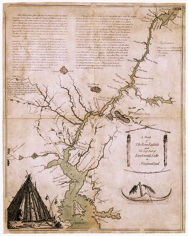
| Maps Home >> Historical Maps >> 1700's >> Exploits River, Newfoundland, and Beothuk villages along the riverbank, 1773 |
Image has been Resized!
 View Full Image
View Full Image
|
Description This is the map which accompanied the report written by John Cartwright, a magistrate in Newfoundland from 1768 to 1773, on the intolerable situation of Newfoundlands Native populations. The map contains information on the now-extinct Beothuk people and shows the location of their villages and the fences they built in order to catch caribou |
Posted Comments
No comments. Why don't you go ahead and post one!?
You want to post comments ? First you must Register!
Canada Kicks Ass!
Commented Pics
 Sex Flow Chart in Gender Humour
November 15th, 2020 by cobrass Divine Light in Gender Humour
November 15th, 2020 by cobrass Ash in Babe Wallpapers
August 15th, 2020 by Vanucx Maple Leaf Collage in Maple Leaf
October 12th, 2018 by homebound Another Chinese Toy Recall in Illusions
November 6th, 2016 by Hyack
