
Canadian Maps
139 Maps
| Maps Home >> Historical Maps >> 1700's >> Western Canada, 1754 |
Image has been Resized!
 View Full Image
View Full Image
|
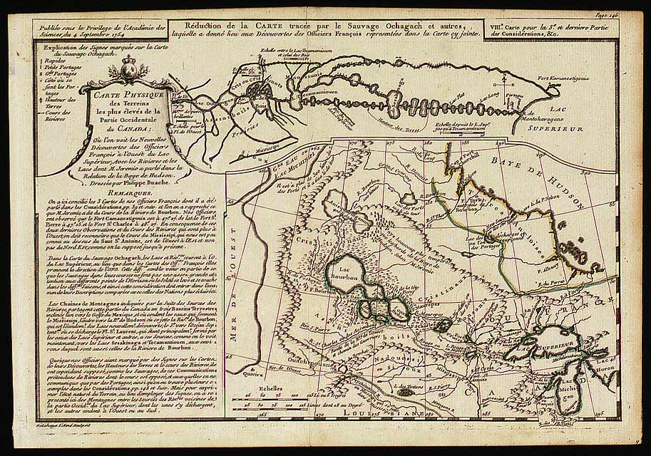
Description The information provided by Native people helped the Europeans understand the geography of Canada. The upper portion of this map contains a reproduction of the "Ochagach map" which bears the name of an Indian who, around 1728, mapped out the route westward from Lake Superior.
|
Posted Comments
No comments. Why don't you go ahead and post one!?
You want to post comments ? First you must Register!
Canada Kicks Ass!
Commented Pics
 Sex Flow Chart in Gender Humour
November 15th, 2020 by cobrass Divine Light in Gender Humour
November 15th, 2020 by cobrass Ash in Babe Wallpapers
August 15th, 2020 by Vanucx Maple Leaf Collage in Maple Leaf
October 12th, 2018 by homebound Another Chinese Toy Recall in Illusions
November 6th, 2016 by Hyack
