
Canadian Maps
139 Maps
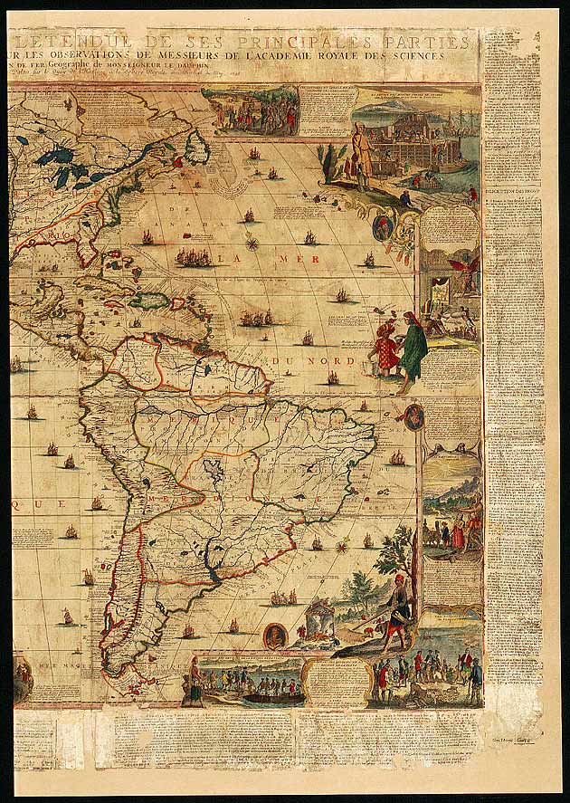
| Maps Home >> Historical Maps >> 1600's & Earlier >> America by Nicolas de Fer, 1698 |
Image has been Resized!
 View Full Image
View Full Image
|
Description This map is up to date even though California is shown as an island (a notion that persisted for some time), but it is best known for the illustrations of cod drying and beavers building dams |
Posted Comments
No comments. Why don't you go ahead and post one!?
You want to post comments ? First you must Register!
Canada Kicks Ass!
Commented Pics
 Sex Flow Chart in Gender Humour
November 15th, 2020 by cobrass Divine Light in Gender Humour
November 15th, 2020 by cobrass Ash in Babe Wallpapers
August 15th, 2020 by Vanucx Maple Leaf Collage in Maple Leaf
October 12th, 2018 by homebound Another Chinese Toy Recall in Illusions
November 6th, 2016 by Hyack
