
Canadian Maps
139 Maps
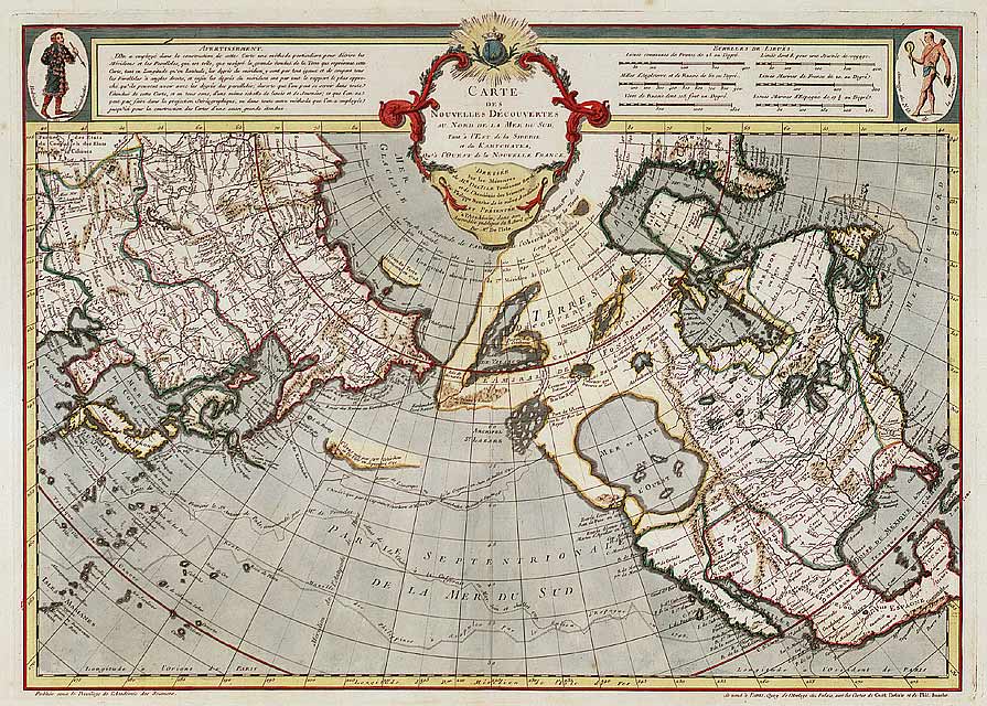
| Maps Home >> Historical Maps >> 1700's >> North America by Philippe Buache, 1752 |
Image has been Resized!
 View Full Image
View Full Image
|
Description The northern and western parts of the continent were subject to misinterpretation of data. The obsession with finding a northwest passage and providing some idea of the geography of the continent west of the Rockies was haunting. It would be decades before the map of Canada was complete.
|
Posted Comments
No comments. Why don't you go ahead and post one!?
You want to post comments ? First you must Register!
Canada Kicks Ass!
Commented Pics
 Sex Flow Chart in Gender Humour
November 15th, 2020 by cobrass Divine Light in Gender Humour
November 15th, 2020 by cobrass Ash in Babe Wallpapers
August 15th, 2020 by Vanucx Maple Leaf Collage in Maple Leaf
October 12th, 2018 by homebound Another Chinese Toy Recall in Illusions
November 6th, 2016 by Hyack
