
Canadian Maps
139 Maps
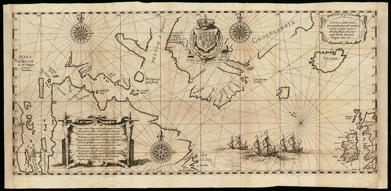
| Maps Home >> Historical Maps >> 1600's & Earlier >> Hudson Bay region, 1612 |
Image has been Resized!
 View Full Image
View Full Image
|
Description Henry Hudson arrived in Arctic waters in 1610 determined to find the Northwest Passage. He explored Hudson Bay and the mouth of the Bay. His crew mutinied and abandoned him in 1611 and returned to Europe. This map by Dutch cartographer Gerritsz is based on Hudsons discoveries. Hudsons explorations were a major factor in subsequent English domination in the Arctic.
|
Posted Comments
No comments. Why don't you go ahead and post one!?
You want to post comments ? First you must Register!
Canada Kicks Ass!
Commented Pics
 Sex Flow Chart in Gender Humour
November 15th, 2020 by cobrass Divine Light in Gender Humour
November 15th, 2020 by cobrass Ash in Babe Wallpapers
August 15th, 2020 by Vanucx Maple Leaf Collage in Maple Leaf
October 12th, 2018 by homebound Another Chinese Toy Recall in Illusions
November 6th, 2016 by Hyack
