
Canadian Maps
139 Maps
| Maps Home >> Historical Maps >> 1700's >> New France 1741.jpg |
Image has been Resized!
 View Full Image
View Full Image
|
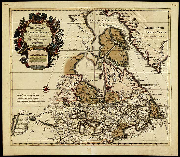
Description New France by Guillaume De lIsle, 1741
A fine summary of French explorations, the map first appeared in 1703 and was updated until 1790. It is the first map to show lines of latitude and longitude fairly accurately.
|
Canada Kicks Ass!
Commented Pics
 Sex Flow Chart in Gender Humour
November 15th, 2020 by cobrass Divine Light in Gender Humour
November 15th, 2020 by cobrass Ash in Babe Wallpapers
August 15th, 2020 by Vanucx Maple Leaf Collage in Maple Leaf
October 12th, 2018 by homebound Another Chinese Toy Recall in Illusions
November 6th, 2016 by Hyack
Canadian Content
Latest Topics in Canadian Forums
- Benign Apathy
[Canadian Politics] Last post by Scape - Federal budget 2024: Billions in new spending, $39.8B defici
[Current Events] Last post by Scape - Canada's Most Dangerous Politician
[Canadian Politics] Last post by Scape
